Know Your Markers Before You Set Sail!
Buoys are considered the “road signs” of the water. Some fixed signs on poles or bridges also provide instructions and reminders for boaters and other lake users about regulations and some known hazards. It is important to remember that buoys are strategically located to balance navigation needs, financial costs, and use of the lake without the markers becoming obstructions. Therefore, lake users are responsible for understanding the regulations, slow/no wake distances, and be aware of potential dangers given the change in seasonal and yearly lake characteristics such as fluctuating water levels. Swimmers and other lake users should also recognize the types of buoys and potential hazards to prevent accidents.
Test Your Skills- Buoy Distance Markers
Know the Distance, Go the Distance
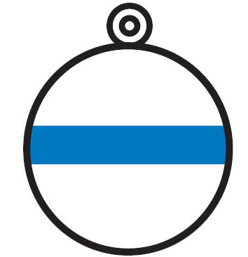
Can you tell the distance of 150 feet or 300 feet on the water? In 2022, we installed distance buoy markers at the Cook’s Bay public launch at Surfside Park to help you test your skills.
Right now, there is a five-miles-per-hour speed limit on all boats within 150 feet from the shore, docks, anchored boats, swimmers, or scuba divers’ warning flags.
Beginning January 1, 2023, boats will be required to maintain a five-mile-per-hour speed limit within 300 feet from the shore and within 150 feet from docks, anchored boats, swimmers, or scuba divers’ warning flags. Learn more about the new rule here.
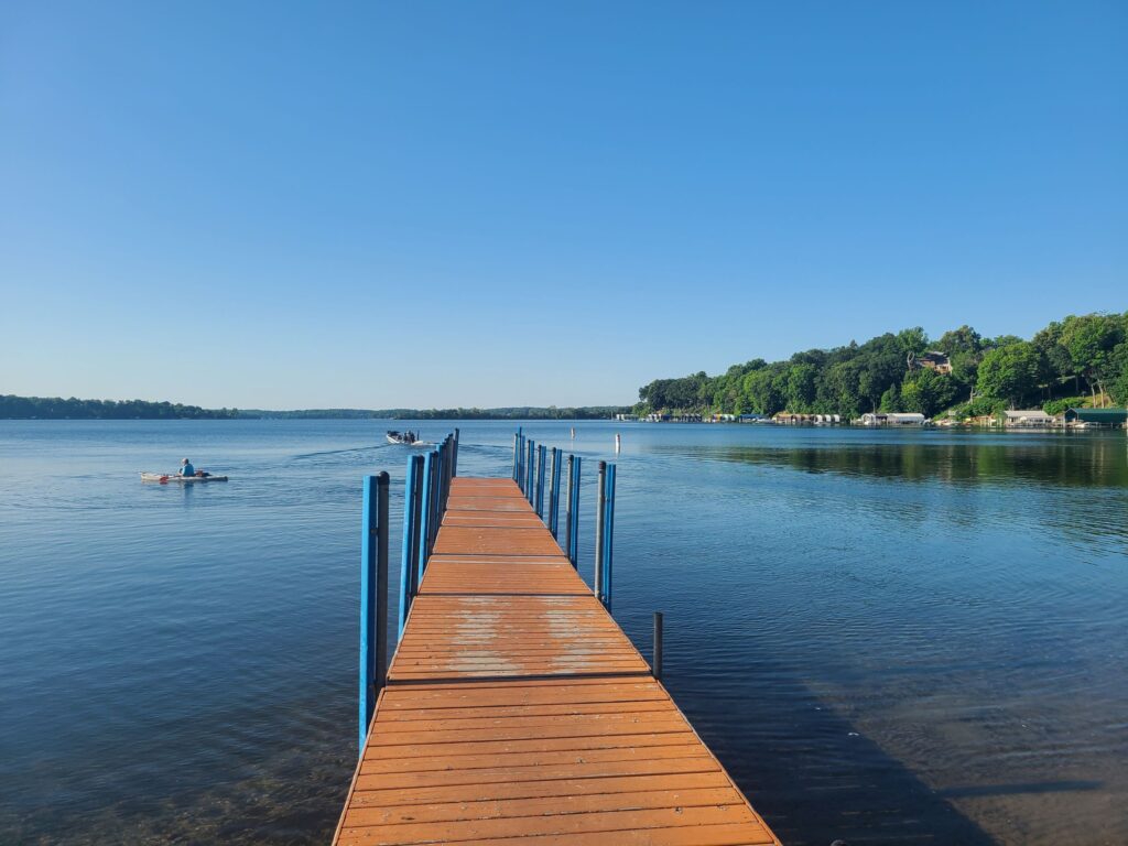
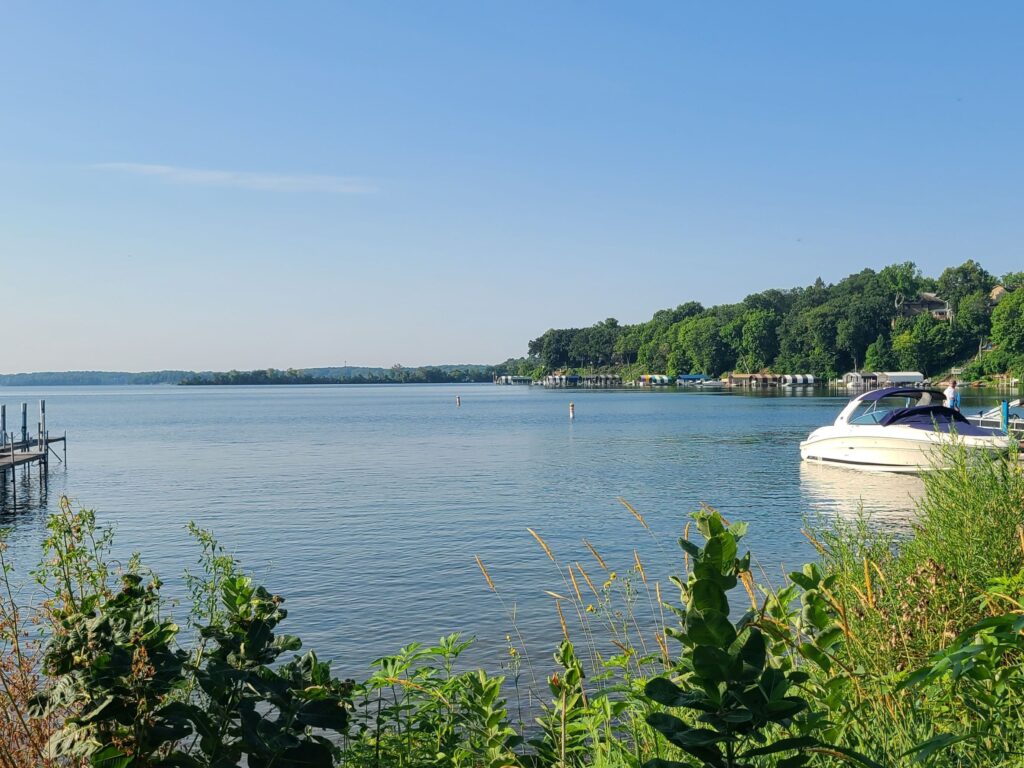
The pictures above were taken at Cook’s Bay public launch on July 12 and July 29, 2022. If you look closely, you can spot the 150-foot and 300-foot buoys. The 150-foot and 300-foot distances were measured starting at the end of the public launch dock.
  | Green & Red BuoysA channel lies between green and red markers. A channel may appear to be defined by land, but it may also be defined by physical characteristics under water such as rocks or shallow water. Keep green buoy markers on your left (port) side when heading upstream. Keep red buoy markers on your right (starboard) side when heading up stream. Some red and green channel buoys are lit by solar lights to help with navigation through certain designated channel areas during nighttime or sudden inclement weather. Please contact LMCD to report specific locations of damaged or nonworking lights. |
 | Obstruction BuoyA black and white vertically striped marker indicates an underwater obstruction. Do not pass between multiple markers of this type or between this marker and the shoreline. |
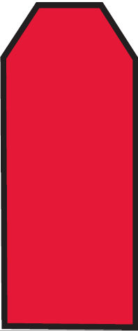
 | Mooring BuoyA round and horizontally striped mooring buoy is used to secure vessels. This is the only marker that a boat can legally be tied to as part of a multiple dock license from the LMCD or in a lakeshore property owner’s dock use area. Be aware that a vessel may be secured to such a buoy or a buoy may exist alone in the water when a vessel is not moored to it. |
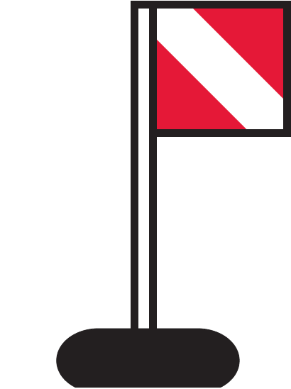 | Diving BuoyA diving flag is used to indicate the presence of divers in the area. This means a boater must keep at least 150 feet away from the flag or a greater distance if needed to prevent unreasonable wakes. Navigate with extra caution in this area. |
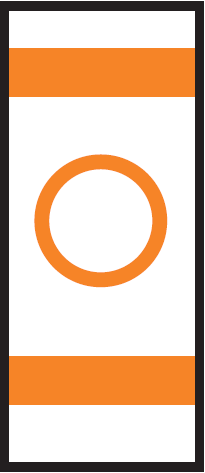 | Controlled Area BuoyA marker with a circle indicates rules in a controlled or regulated area, such as speed limits, slow/no-wake, and wash restrictions. Follow the restrictions displayed within the orange circle. On Lake Minnetonka, controlled areas also exist throughout the lake even if a buoy is not present. A baseline slow/minimum wake areas of at least 150 feet for general watercraft and 300 feet for Personal Watercraft performing repetitive passes. These minimum distances are from shorelines, docks, swim areas, and anchored watercraft.Distances may need to be greater to reduce wakes if the wakes are high enough to be harmful to lakeshore, docks, anchored fisher people or other lake users. Certain areas are designated as Quiet Water Areas all the time or during certain times. Learn about Own Your Wake for Everyone’s Sake. |
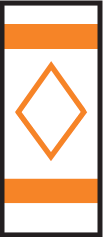 | Danger BuoyThe diamond shape on this marker indicates the presence of nearby dangers such as shoals and rocks. Information about the hazard is displayed within the orange diamond. |
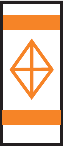 | Keep Out BuoyA diamond shape with a cross indicates exclusion or closed areas where boats are prohibited. Steer clear! |
 | Information BuoyA marker with a square provides helpful information such as directions, distances, and locations in the area. Use the information inside the square as a guide. |
Requests for Additional Buoys
Requests for additional buoys are made each year throughout the lake. It is important to remember that buoys are strategically located to balance navigation needs, financial costs, and use of the lake without the markers becoming obstructions. Installation of more buoys is not always effective in addressing concerns. Public education has increased to inform the public about proper and safe navigation. With the increase of lake use, LMCD increased funding for water patrol services during the summer to aid in enforcement of regulations and for emergency response.
To request installation of additional public or private buoys, a letter may be submitted to the LMCD Office to request the installation of additional public or private buoys. Sufficient evidence must be submitted to support the installation of additional buoys at the location. Providing video and photo evidence of the potentially dangerous or destructive circumstances is helpful when presenting the request to the LMCD Board of Directors.
Public Buoys
Public buoys may be requested by members of the public. The Board may choose to install public buoys and pay for the costs. The board has opted to install public buoys in the past for Big Island and Quiet Water Areas after significant review of the area over a summer or more.
Private Buoys
In certain cases, the board may approve private buoys—for which the costs, installation, and liability would be a private party’s responsibility. Buoys must meet the required US Coast Guard and MN DNR specifications. Representatives of a party, mostly research projects, must apply for a permit to install private buoys beyond 200 feet from shore (under both temporary structure and special event permits) and other conditions may apply. Historically, staff works with the Hennepin County Sheriff’s Office Water Patrol Unit (HCSO Water Patrol) for the issuance of temporary structure permits.
Requests for Quiet Waters Area (QWA)
In other cases, the board may approve designate a quiet waters area (QWA) in an area where there are expressed concerns for public safety, traffic violations, and environmental impacts. A petition may be submitted to the LMCD to request the the designation of a QWA. LMCD staff will review the request by conducting observations at the site on separate occasions throughout the summer or two to gather video, photo, and written evidence of potentially dangerous circumstances. LMCD staff will present the findings related to public safety, record of traffic violations, concern for environmental impacts, or other concerns to the board for review.
LMCD staff has received requests for QWAs in previous years. Most recently, the LMCD Board approved a request for QWA at Cedar Point West buoy channel between Cooks Bay and West Upper Lake. QWAs are listed in the 2022 Summer Rules Brochure in a map displaying the designated areas.
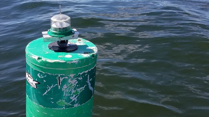
Solar Lights
Over one hundred solar lights are installed on channel navigation buoys across Lake Minnetonka each boating season. The solar light program is funded by contributions to Save the Lake and volunteers assist in the program. Broken or loose solar lights should be reported to the LMCD office with the specific location identified.